GeoServer Django Integration
A lightweight Django application for creating interactive geospatial web maps using GeoServer and Leaflet. This project provides a modern, responsive UI built with Tailwind CSS and Flowbite to visualize and interact with GeoServer layers.
1. Technologies Used
GeoServer, Django, Leaflet, Tailwind CSS, Flowbite, OGC Web Services
2. Project Description
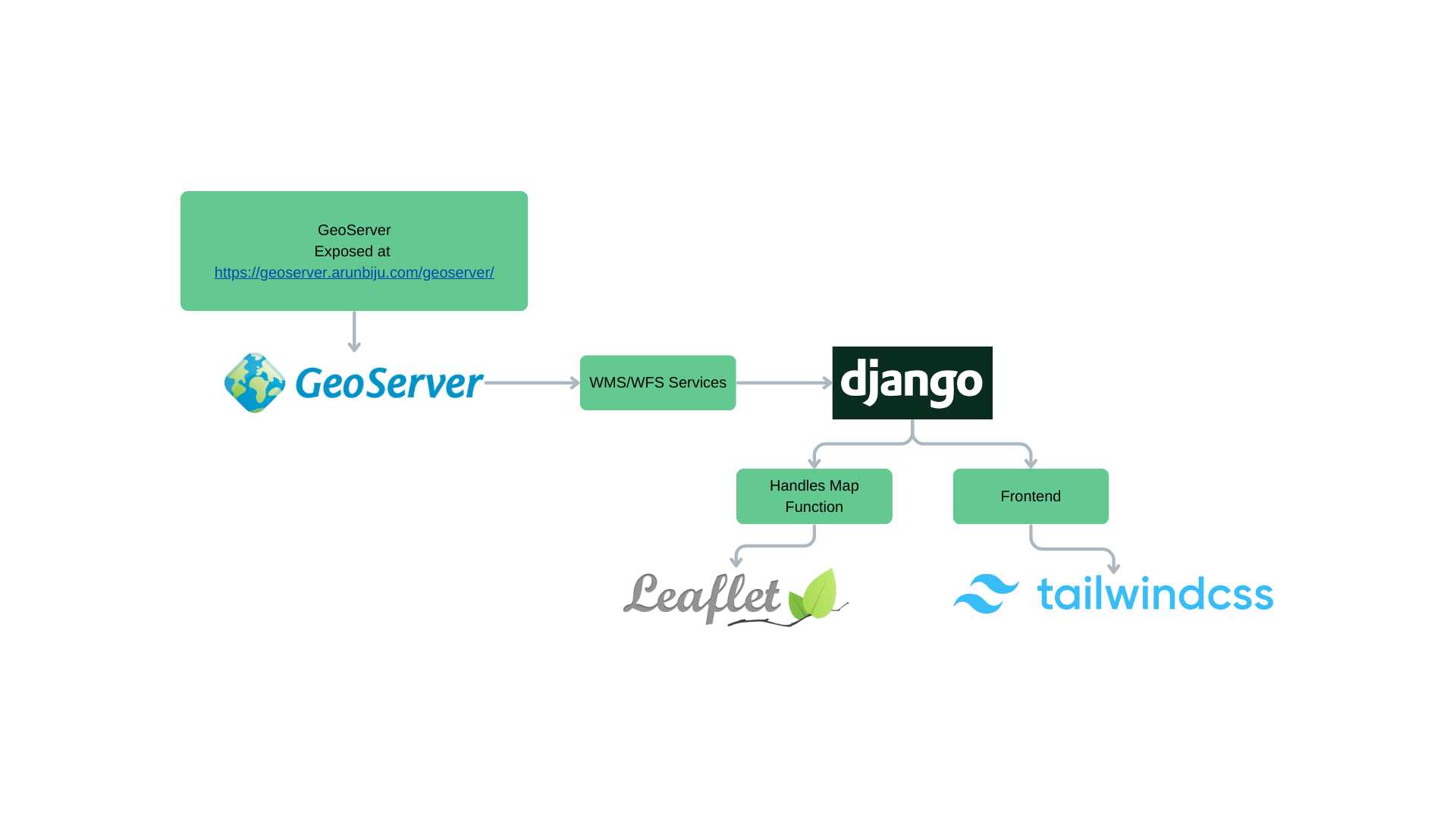
This application features a lightweight approach to geospatial web development that efficiently combines several key technologies. GeoServer forms the backbone of spatial operations, managing all geospatial data and delivering standardized OGC services including WMS and WFS. Django handles the application flow and provides a robust framework for storing and managing layer metadata. On the frontend, Leaflet offers powerful client-side map rendering and interactive capabilities, while Tailwind CSS and Flowbite create a responsive and modern user interface. The application follows a clear separation of concerns in its geospatial workflow: GeoServer manages and exposes spatial data through standardized web services, Django stores and organizes metadata about GeoServer layers and workspaces, and the web interface uses Leaflet to communicate with GeoServer through WMS/WFS protocols. The system is designed for simplified deployment, with configuration files specifically optimized for Vercel hosting environments.
3. Key Features
4. Why This Project?
This project bridges the gap between powerful geospatial backend services and modern web development, making it easier for organizations to publish and interact with their spatial data through intuitive web interfaces.